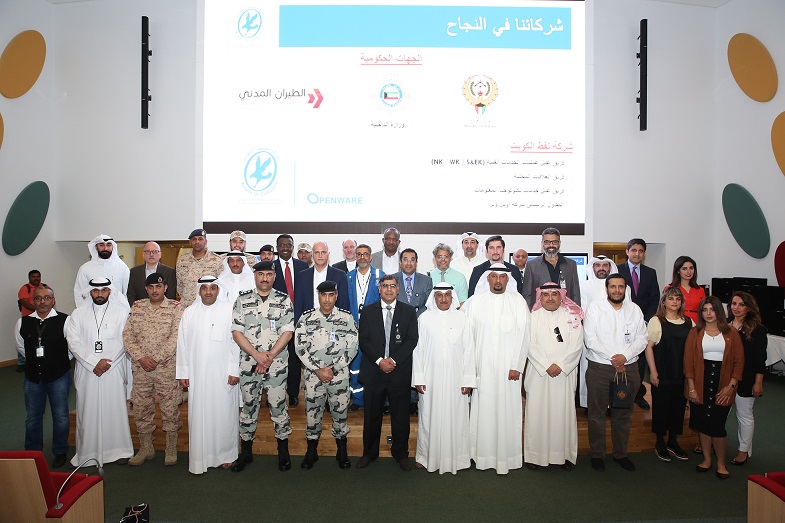
In consecration for its regional and global lead role, KOC continuously strives to enhance the accuracy and quality of the data it uses to achieve the highest degree of efficiency in its production processes and in supporting decision-making for project implementation through the development of working procedures and the adoption the latest state-of-the-art technologies.
In this context, the company has finished the implementation of a 3D aerial surveying, which is part of a major plan for the oil fields. This allows the company to set up an up-to-date database for geographical information systems, including the infrastructure in all the areas covered by the company's operations.
This high quality and precision survey included all the fields of Kuwait, the area of which is estimated at 8,000 square kilometers and was carried out in cooperation with various local and foreign authorities.
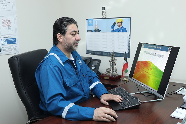
We met with the Senior Geographical Information Systems Analyst in the Technical Operations Services Team (North Kuwait) Faisal al-Boos, who told us about this survey which serves many aspects included in the “New Kuwait 2035" vision and leads to the revision of the 3D maps relative to the identification of physical features and field details, in addition to taking high resolution aerial photos.
Major Plan
Al-Boos said that oil and gas are considered as an integral part of the infrastructure in many countries, ranging from the exploration of sites and extraction to the management of field work and even the processes of materials transportation, with Geographical Information Systems playing a major part in this business. That is why it is very easy to see the outcome of the use of geographical information systems in this field because building a modern spatial geographical database is considered as the first step to its effective implementation.
He added that this was the reason for naming one of the major outcomes of this project as “The Major Plan for the services of KOC in the oil fields (South, West, North and East Kuwait)". It consists of developing a modern database for geographical information systems including all the infrastructure in all the areas of the company's operations.
Aerial Photography
He pointed out that the idea of direct aerial photography came from the reality of work experience in the area of field surveying, and the challenges that were faced by the work teams when covering large areas, multiple services and dangerous sites. Hence the need for improving performance. So, it was obvious to use aerial photography technology, after research and discussions which led to the conviction that aerial photography through the use of planes (in comparison to satellite photography or photography through the use of drones) is more suitable and accurate, in addition to the integration of all that with 3D laser surveying.
He explained that Kuwait Oil Company (KOC) used the outputs and information in a wide array of geographical information system applications for producing maps and making decisions. Through this survey, they aim to provide an accurate and comprehensive digital topographical database, high-resolution digital color photographs for the oil fields of the company, using the latest technology to get a 3D digital sample for the physical features on the surface of the earth in the fields. This saves time and cost for surveying remote locations, detecting the places that are too difficult to reach without exposing the workers to any risk and producing a 3D digital sample which will for the first time cover all the fields with unprecedented accuracy at the level of Kuwait. This will pave the way for many other applications in the activities of the company, underscoring the positive effect it will have on the quality and accuracy of the data used in daily planning and operations and the functions of health, security and the environment.
Collective Coordination
Al-Boos said that there are many authorities who collaborated for successfully completing this survey and coordinated among them to issue the approvals and permits with the assistance of the Local Relations Team. Among these authorities, we find the executing company, which is an (American company), and the Public Authority of Civil Aviation, whose role consisted of coordinating the take-off, flying and safe landing and make sure there is no conflict with the various flight schedules (Civil and Military). Then, we find the Ministry of the interior, which worked for coordinating the operations of terrestrial supervision support for the photography. The ministry of defense took care of coordinating the works of observation and keeping the security of the defense sites. Last, but not least, the ministry of the foreign affairs took on the responsibility of coordinating the tasks of flying and detection in the border regions.
Al-Boos praised the cooperation with all the authorities, which contributed much to the success of the mission, expressing his thanks and consideration for the officials and workers alike. He also expressed the pride of the three technical services operations (North Kuwait, West Kuwait and South & East Kuwait) of keeping their capacity to hand over data in the prescribed time and outright approval of delivery, pointing out that these results have been achieved through reliance on an expert and achievement-oriented work group for aerial photography and geographical information systems.
He revealed the successful completion of this survey required effort coordination from everybody, including the appointment of a project manager for this contract, because project management is essentially an application of knowledge, skills, tools and technologies in the project activities not only in order to cater for the needs and expectations of the client, but also to go beyond them.
Responsible Units
He added that the infrastructure units of the afore-mentioned work teams played an important part in this survey as they acted as the major contact point for all the matters related to production and procedures and were responsible for the coordination of the project activities in addition to a score of other missions, including;
Project Preparation and Pre-planning
Overview and assessment of the technical capabilities of the bidders and choosing the successful bidder.
- Overview and review of the specifications.
- Defining the scope of work.
- Defining the executive procedures.
- Setting up approval criteria and defining them with the contractor.
- Setting up plans and documents for quality assurance and control.
- Clarifying special requirements.
The Stages of the Project Implementation:
- Preparing project work schedules
- Directing the project's steps
- Coordination with the production components
- Defining the required resources
- Provision of technical supervision
- Project status follow-up
- Assuring the quality of the project outputs and monitoring them
- Continuous communication with all the authorities and teams involved.
A role from the very beginning
He pointed out that the role of the infrastructure units started in the stage of proposal, as a preliminary design of the work plan was handed in in addition to the budget approval. Then, its role continued during the stages of contracting and production for implementing the survey.
He touched on the coordination process with all the authorities involved in the survey, pointing out that talks with external authorities were carried out officially through the Local Relations Team who exerted tremendous efforts that allowed to overcome all the difficulties and speed up the tasks.
Al-Boos added that work on this survey started in 2016, whereas effective start of implementation of the survey tasks started in February, 2019. This was preceded by a period of more than a year, during which the necessary permits and approvals were obtained. It was followed by consecutive steps, some of which are still going on, including the implementation of reference land marks and detecting them through high resolution surveying along with the implementation of the daily flying and photographing tasks. Weather conditions were taken into consideration and re-photographing tasks were undertaken for some sites to improve image quality and finalize the photographing task. Moreover, the photos were audited and collected digitally. 3-D engineering drawing tasks were carried out in addition to field scrutiny and collection of necessary information.
Many Beneficiaries
He assured that many work teams in the company would benefit from this work, especially those working in the fields, including the exploration, field development, maintenance, health & security and the environment teams, in addition to the Local Relations Team that works closely with government authorities based on the plans of the technical services teams.
He clarified that this survey contributed to updating and developing a detailed plan of all the oil fields related to the company, as it was, for the first time, possible to provide an accurate sample of the land surface features in the fields. He added that the new data would allow to undertake spatial analysis tasks and activate them in the resources department, reduce costs, risk analysis and prepare a sample of possible scenarios, which would open new horizons for the study of future projects and field development works. It will help with production operations support and relevant decision-making to achieve the New Kuwait 2035 vision and the strategy of the company for 2040.
Various Challenges
As for the challenges the surveying encountered, he clarified that they were especially of a logistic type. Other challenges had to do with the issuance of permits and approvals in addition to the availability of pilots and airplane maintenance. Weather condition challenges were also encountered because it was necessary to take the photos in a special season where the angle of sunrays and temperature should be suitable. It was also necessary to take the photos at a certain time of the day to guarantee that the shade influence is kept to a minimum and always make sure of the suitability of weather conditions, as they should not feature impurities, clouds or high winds.
He recalled how the vapor resulting from the burning process in some sites hindered aerial vision for the oil production facilities. To overcome this, re-flying operations were planned on certain areas and implementing them at the right time in coordination with the production teams.
He added that they had difficulty with the hiring of staff who have the required technical experience in the collection of 3-D data during the spread of the Corona pandemic, which was due to a lack of skills, especially in 2020 when it was difficult to import technically skilled foreign labor. As a result, an assessment of the man power that was available locally to the contractor was made and the gap was filled through training.
Those challenges slowed down the surveying tasks, but the situation was exploited to update the risks register and draw lessons for future projects. He pointed out that dealing professionally with such a huge amount of digitalized data the huge amount of data required special and meticulous planning.
Direct Support
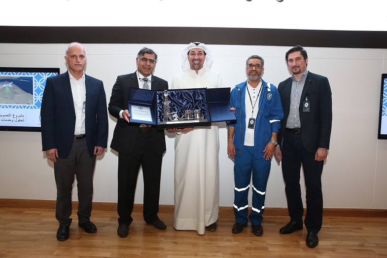
He said that they received direct support from the leadership of the company. This support consisted of facilitating the tasks, reducing difficulties, pushing firmly towards implementation, encouragement and praise of what has been gradually achieved. The highest ranking positions in the company showed great interest, which underscores the importance they attach to this achievement. In fact, this acted as a drive to the Infrastructure Units to keep on working with steady steps.
As for future projects, Feisal al-Boos firmly confirmed that the work team he has the honor to belong to – the Technical Services Operations team (North Kuwait) - has unlimited ambition and yearning for improving the work of the company. He added that he is striving to build upon what his predecessors did to improve the performance of the company, enhance its local and regional competitiveness and keep its international position, which urges the team to continuously search for what is new, beneficent and creative.
In this context, he revealed that the team has many suggestions to make with regard to Geographical Information Systems (GIS), wishing that Allah, the Almighty, will bring them success in achieving some of them in the near future, including, for example, the work related to the Great Burgan Well.
For further clarification, al-Boos declared, as everybody knows, the Burgan field reached an advanced stage of maturity and congestion with services and, therefore, there is an intention for the use of geographical information systems to face future challenges and provide the necessary land for making future projects on this field. This could be achieved by concocting a comprehensive plan for fields' development in realization of the company's 2040 strategy.